
Flooding and Drought in the Watershed
- Mika

- Sep 24, 2023
- 2 min read
Updated: Dec 6, 2023
Flood Conditions
The Edmonds Marsh was historically much larger than it is today, encompassing around 100 acres. It was also tidally connected to the Puget Sound, making flooding historically common. Today, a tide gate is used to manage the flow of tidal water into the marsh, and much of what once was marshland is now developed into the downtown and surrounding communities. The map below shows the historical footprint of the marsh overlaid onto a more recent satellite image of Edmonds.

Today, the map of a 1% chance flood from FEMA looks remarkably similar to this historical marsh footprint, shown below. There are numerous examples of flooding in this area from just the past decade, as well, despite many efforts by the city to control the problem.


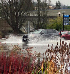
Floods are often caused by excessive rainfall overwhelming stormwater systems or king tides. River flooding is less common, as the Shelleberger Creek and Willow Creek are piped underground for much of their runs and convey relatively small amounts of water.
Drought Conditions
While the Pacific Northwest is known for its rainfall, the region has been faced by drought as well, defined as times of year when there is less precipitation compared to the historical record. The maps below show the droughts and wet periods since 1895. As of this writing, the area is in a drought categorized as 'severe' which began at the start of this summer. As the wet season comes in, this is likely to end. As can be seen in the time series, wet conditions have been becoming more likely over the past 150 years while droughts seem to be getting more scarce.


References
A Marsh Through Time. (n.d.). Edmonds Marsh Estuary Advocates. Retrieved September 24, 2023, from https://www.edmondsmarshestuary.org/amarshthroughtime
Conditions for Edmonds, WA. (2023, September 21). Drought.gov; NOAA, NIDIS.
FEMA’s National Flood Hazard Layer (NFHL) Viewer. (n.d.). Web AppBuilder for ArcGIS. Retrieved September 24, 2023, from https://hazards-fema.maps.arcgis.com/apps/webappviewer/index.html?id=8b0adb51996444d4879338b5529aa9cd
Flooding at the usual spot in Edmonds. (2023, January 3). Edmonds Beacon. https://www.edmondsbeacon.com/story/2022/12/22/news/flooding-at-the-usual-spot-in-edmonds/27853.html
Heavy rain floods Edmonds Monday - followed by snow. (2020, December 22). My Edmonds News. https://myedmondsnews.com/2020/12/heavy-rain-floods-edmonds-monday/
Snohomish County. (2023, September 21). US Drought Monitor. https://droughtmonitor.unl.edu/CurrentMap/StateDroughtMonitor.aspx?fips_53061


